HIGH-VALUE PROPERTIES
Testing Facilities
Grants Pass, Oregon
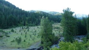
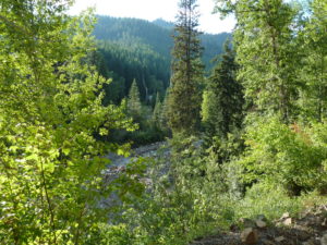
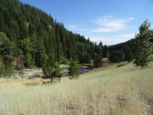
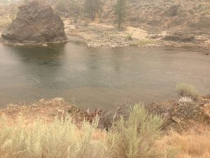
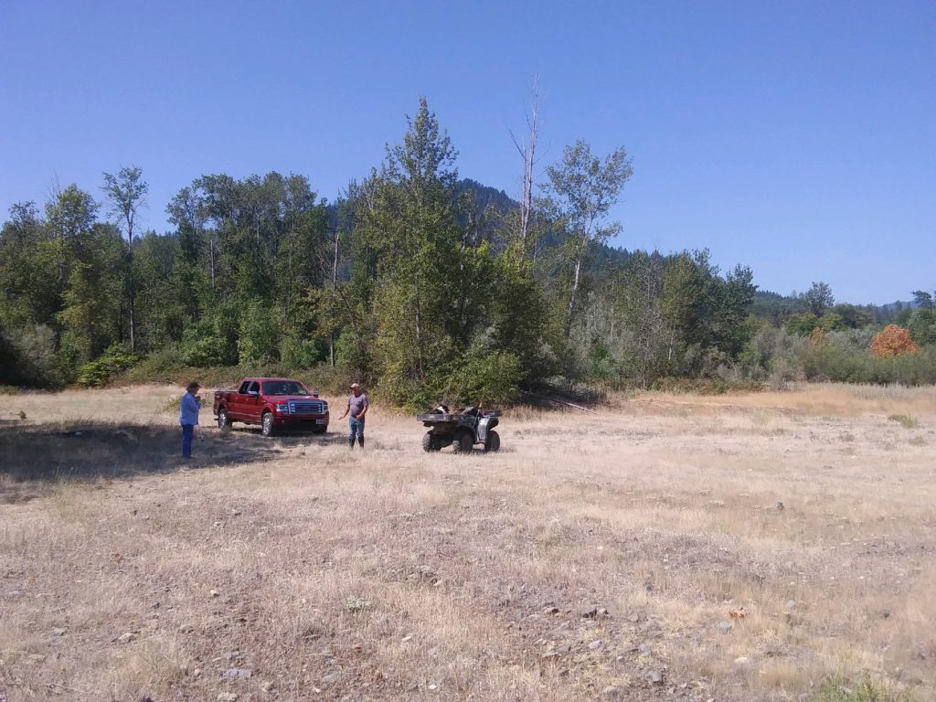
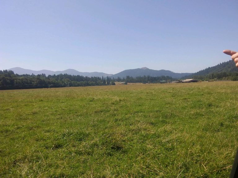
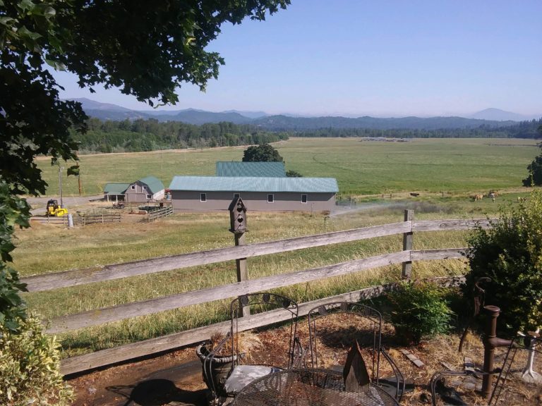
Prototype development, testing and trials will take place on a large cattle and horse ranch within a dozen miles of the Southern Oregon City of Grants Pass.
Property Description:
Initially we will have 40 secluded acres within a stone’s through of the Applegate River and near the Rogue River. Both rivers are known for their historic gold production. Approximately 1,000 acres is irrigated grazing property. Two roads provide good access to the property and are gated with code controls. The two rivers keep other access limited to a few intrepid fishermen.
There are living facilities available for a small crew and room to park motorhomes for all others including a gold sampling motor home for analysis.
Logistics:
Grants Pass is a large Southern Oregon city within the I-5 corridor – interstate freeway connecting Canada to Mexico. It has a population of 40,000 consisting of mostly conservative retirees. Parts, trucking, fuel, engineering, equipment, human resources are all abundantly available. Communications are accessible at the site for rapid response in case of medical and police emergencies.
Property Rental:
To be negotiated; however, the owners have an interest in HERC Gold Corporation and also are curious about their property’s gold potential. Rental would also include the use of an excavator and D-4 Cat with operators plus various other equipment. Asking for a six month lease with option to renew for another six months.
Geospatial Survey:
As is the case with all property prior to and during Beta testing, this property will be thoroughly examined by geospatial tools including satellite imaging, remote sensing technologies, seismic sensing, global positioning, and various “well logging” data gathering techniques. The testing goal is to determine the most probable areas to test drill for concentration of minerals and thereby reduce time and costs to isolate actual mining targets. The testing technology will be measured for cost verses our benefit.
It should be noted that in the last decade, geospatial techniques, remote sensing, seismic technology, and many other technologies have evolved dramatically in innovative applications for identifying subsurface concentrations of oil, gas, and minerals. Its use has been somewhat limited to very large projects. We intend to investigate all applications useful in predicting a plausible exploration array to sample an area with high confidence in locating a viable mining site.
Classification of Mineral Property:
An inferred mineral gold source. Historical mining experienced conglomerate that was cemented making mining very difficult even though it is within 15 to 25 feet of the surface. Ideal for testing jetting system and borehole configuration and sump trap/ core barrel recovery method.
PLAN OF OPERATION
Hydro-Scopic™ Mining - Implementing Prototype Results
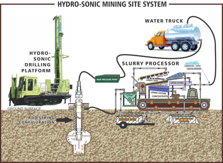
Once the prototype (Beta unit) has been built, tested, and made operational to the fulfillment of the patent claims, the Mormon Basin will be an initial target for Beta testing. All government agencies, permits, private contracts, and preliminary geospatial surveying will be reviewed for approval to test the site. An advanced team (2 people) with a 4 wheel drive pickup and motorhome will visit the site and contract with any local contractors needed for site preparation and possible reclamation if any.
When initial site observation is approved, the equipment will be transported to the Mormon Basin. The advanced team in the interim will travel to the next site at Cornucopia near Half Way, Oregon to make an observation of the suitable environment on this site for Beta testing and then rotate back to the equipment staging area to help transport the Beta unit to the Mormon Basin.
Transportation will include one motorhome for crew accommodation (there is already one on site), another motorhome equipped with a gold room and computer, two 20’ containers on trailers (one 20’ container will carry the sonic drill – 26,000 lbs – and tooling. The second will carry the generator, high pressure pump, other pumps, surface processing plant, and various other attachments for water management). A maintenance truck will carry a fuel tank and tow a trailer with any other equipment that may be needed. The pickup used by the advanced team will also be available and tow a trailer with two atv’s. Any heavy equipment will be rented from local community sources.
Upon arriving at the test site, the two containers will be unloaded and sealed. A water pump will pump water to the first container and fill it with 30 cubic yards of water weighing 42,000 lbs (1,684 lbs per cubic yard). A 20’ container has a total capacity of 43 cubic yards internally. The second container will be used to accumulate the slurry from Beta testing being converted to an Alpha unit for volume production – the conversion will give us a true measure of the gold reserve. Please note that the volume of the cavity created with jetting can be converted to cubic yards by using an external water tube on the containers to measure the volume of water used and comparing it with the measure of slurry and water placed in the other container. Empirical trials can make this an accurate measure of gold recovered per cubic yard of minable material, not including boulders, providing a high confidence level in determining property classification.
Testing will begin with Beta drilling taking core samples at 400 foot surface intervals. Seismic exploration will use sensors in the Beta test holes to record vertical and horizontal shock waves from the sonic acoustics in drilling 400 feet away to create a dimensional view of the subsurface to identify possible concentrations of heavy material. These areas will be extensively sampled to measure the resource.
Most Beta test sites will take a week to 10 days to decide on extending the testing area to further the measuring process. If initial testing shows 4 to 15 grams of gold per cubic yard a limited time extension will be used to prove the resource as a low-value reserve ore body eligible for “franchise mining”. If the resource is above 15 grams per cubic yard it will be classified as a high-value reserve and an extension of time will be used to determine the extent of the reserve. This property will then be assigned to Ursa Minor Corporation for private Alpha unit mining with exceptional profits for us and the mineral right’s owner. Please do not underestimate the value of “franchise mining”, however, as it will pay conversion fees, licensing fees, and royalties with little work or risk from us. After the mineral content has been measured, the containers will be drained and cleaned and the operation will be transported to the next site.
A high-value resource should pay at least 1,000 ounces per month netting Ursa Minor Corporation and shareholders about half that; however, initially the conversion to immediate Alpha mining will not take place and the Beta exploration unit will move on to the next site until another high-value resource is located and measured. The reason is that sites may deplete more quickly than expected or for some other reason mining is terminated on that site – weather, forest fires, litigation, etc. Beginning in two years after funding, the payment of $282,500 to URSA Gold Corporation begins for the purchase of the prototype and cash flow must not be interrupted. Two sources of high value ground paying at least 1,000 ounces per month need to be discovered. Of course if one resource is paying, for example 10 ounces per cubic yard, we will make an exception.
MORMON BASIN
Vale, Oregon
The Mormon Basin in the northeastern region of Oregon has numerous references on the internet under search engine “Mormon Basin Gold Mining”. It is a massive area of placer gold deposits with a great deal of interest and active mining in the last decade. Several placer mining locations in the northern part of the basin have proven to be productive including a specific site with recovered reserves on private property owned by an Oregon Hedge Fund. A website www.mormonbasingold.com describes the property in more detail although a bit outdated on the sales position by the Hedge Fund.
The private property is divided in two parcels of 100 acres each separated by ½ mile. The lower 100 acres was placer mined within the last 15 years with a permitted plan of operations. Mining took place over several years and had more than 20 employees with several rented excavators, cats, and three or four heavy haul trucks. This operation was very profitable in order to sustain these operating costs although an exact gold recovery amount is unknown. The gold laden channel was just above bedrock on the lower 100 acres. The upper 100 acres was set up to be mined but the depth of the channel was beyond costs to sustain a margin of profit needed to justify mining.
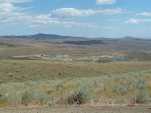
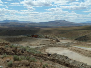
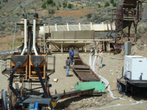
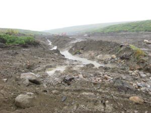
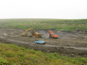
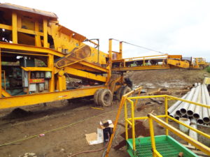
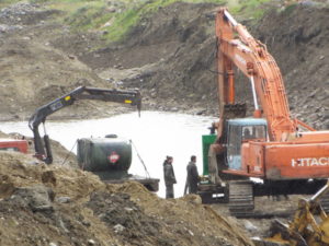
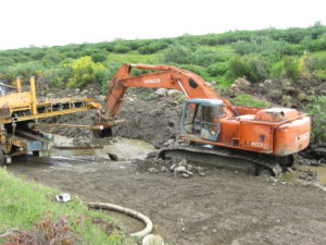
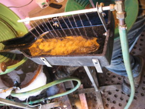
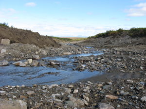
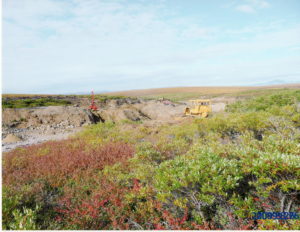
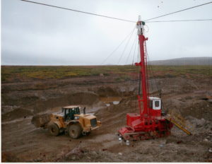
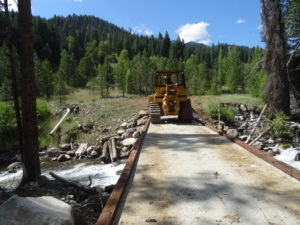
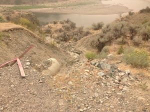
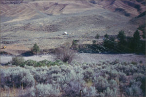
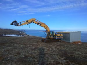
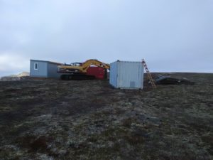
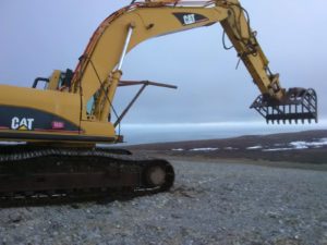
The pictures attached show the processing plant development on the upper 100 acres before it became apparent that the deposit was not feasible to mine with a surface plan of operations. The equipment was soon dismantled and the project was abandoned. Several miners since then have tried to finance mining the upper 100 acres but could not raise the necessary working capital.
Property Description:
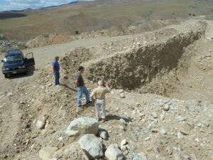
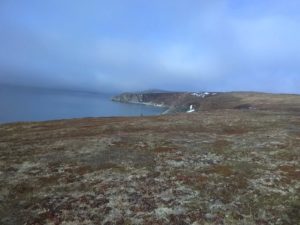
The property has a high dessert environment with little vegetation. Roads are in place and a stream nearby was permitted for mining use by pumping water to the processing plant and draining into settling ponds for a closed mining system. A ridge divides the property with the western slope draining into the stream. Gold was found on both sides of the ridge near the surface but not in quantities to justify large scale mining. The eastern slope has little erosion but has been surface mined by another mining company about a mile to the south which would indicate a channel emanating through this eastern slop drainage; however, excavation as shown in one of the attached figures could not penetrate that channel as it was evidently too deep and boulder laden – a perfect scenario for Hydro-Scopic™ mining.
The property surrounding this private target property is BLM land currently unclaimed as far as we know. The claim or property owner contracting for Beta testing with us will have the right to claim or purchase any surrounding mineral rights that attach to the designated Beta target property. All property beyond that realm will have rights to be acquired by Hydro-Scopic™ Properties, LLC.
Logistics:
The mining location is within an hour to Boise, Idaho and about an hour and a half to Baker Oregon. Both cities are mining conscious and parts, subcontractors, and rental equipment are readily available. Communications are accessible with cell service. Winter operations are hampered by snow accumulation and cold but the Hydro-Scopic™ mining operation is designed for cold weather; however, depending on weather or other issues, the operation can be moved to another resource area like California, Arizona, or Nevada where Hydro-Scopic™ mining prospects can be easily mined during the winter with transport back to the Mormon Basin in the summer. Rapid mobility will be a priority in the design of the process. If production falls off from measured reserves, or the resource is depleted, the process will be moved immediately to another Alpha resource or be used as a Beta Unit for testing other properties.
Environmental and Community Sensitivity:
The Mormon Basin is a very large area with many Beta test sites available for contracting. The more we can involve the community the faster the word gets around that a new environmentally friendly mining process is sampling the area at no cost to the mineral right’s holder – providing there is at least inferred evidence of a viable prospect. This should create an interest with the local news organizations and civic groups as well as the news media in Baker Oregon and Boise Idaho. Actually if the process is as impressive as we believe it will be, we will invite the news reporters to take a look. Of course environmentalists will also be involved.
Since this will be the first serious Beta test site, environmental concerns will be adhered to in all respects. The motor homes will have cooking, toilet, and trash facilities so that nothing is left on the site when testing is complete. Slurry will be pumped back into the drill holes to replenish the cavities created in volume sampling and the holes sealed and recorded with GPS positioning. Even though MSHA will not have time to inspect the operation, their rules will be followed for safety reasons. Any environmental disruption will be discussed with the locals for making the site better than it was.
Classification of Mineral Property:
Since mining has been permitted in the drainage south of the site with obvious profit, the site is classified as an “inferred” mineral resource. The Hedge Fund has had the site for sale but large production levels on the surface have not proven to be cost effective and deep excavation to access the subterranean resource cannot be easily permitted making sale quite difficult. Hydro-Scopic™ mining, on the other hand, with testing at no cost and mining at no cost and a 10% royalty paid to the owner can make the classification a proven reserve with a measured amount of gold that is feasible to mine. Even if the property has 5 grams per cubic yard at 100 feet in boulders, the site would be feasible to mine with “franchise mining”. If mining one shift a day for 25 days a month the property will pay monthly in gold royalties 32 ounces. It was said that the property was paying 7 to 12 grams per yard in the pay streak on the lower 100 acres although this was never confirmed. The associated costs however would indicate at least this much was recovered.
Hydro-Scopic™ mining will have a profound effect on the value of this property and the entire Mormon Basin. There is also deep deposits laden with gold in the surrounding area that could be tested and measured for Hydro-Scopic™ mining. This is an excellent test site to prove the effectiveness of Hydro-Scopic™ mining and substantially revalue the local mining area with millions to be made for the owners if their mineral rights prove to be a high-value resource. It’s kind of like a million dollar mineral rights lottery payable in gold with really great odds for the property owner.
SHERRETTE CREEK
Mile Post 47, Kougarok Rd; Nome, Alaska
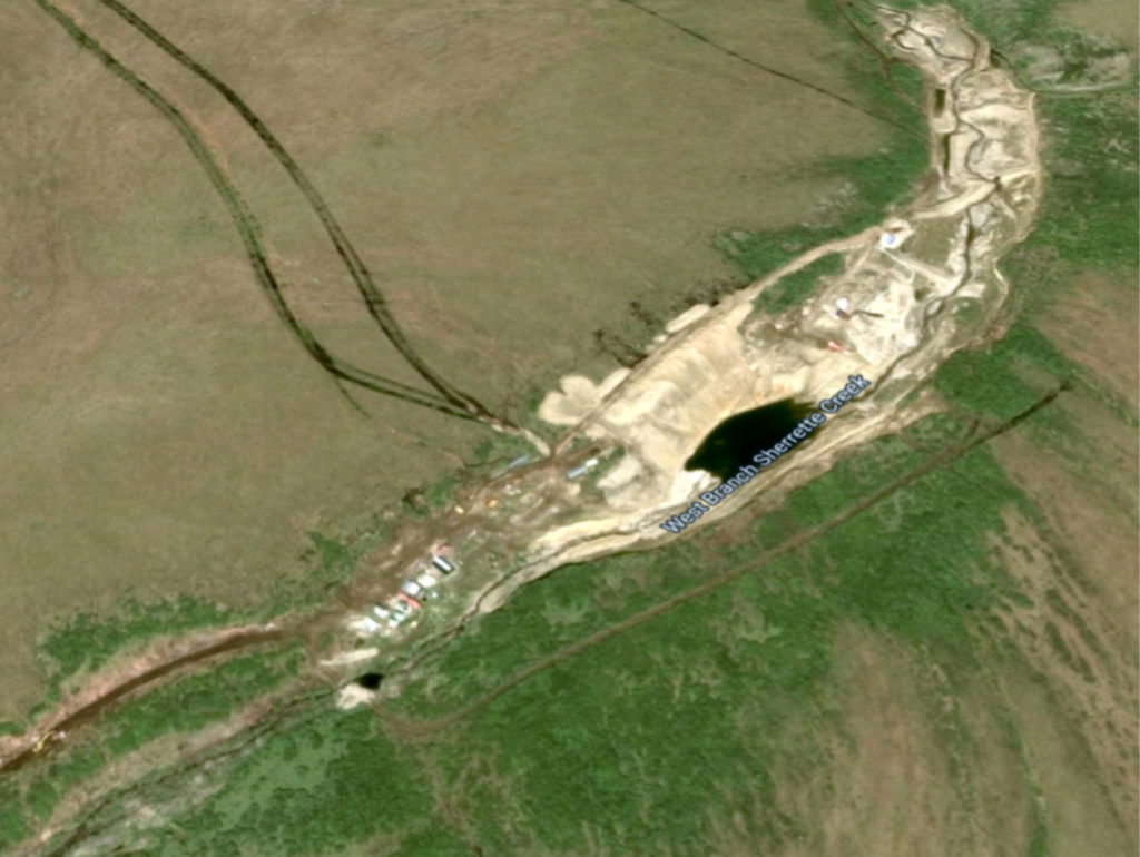
- www.auplacer.com – original website describing the mining operation funded by Alaska Mines Corporation. The right hand column shows a menu button for the original 1908 mining report and a mining report in 2004 by James Halloran – a well-known mining consultant in Alaska. Jim Halloran has written many articles published in the California Mining Journal and elsewhere about placer mining in Alaska. The website and mining reports are well documented for further information.
- www.aualaska.com – this is the last website that was developed that showed the last mining season on Sherette Creek before the surface gold dwindled to a point it was not profitable to mine. It has some good pictures and video.
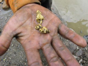
- www.nomegoldadventures.com – this is an entertaining website designed to attract tourists to an adventure in real gold mining. Unfortunately, the surface gold played out before we could implement the company. The website was based on Sherrette Creek and provides good pictures of gold and the operation when it was mining gold.
Property Description:
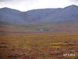
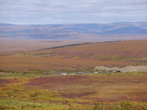
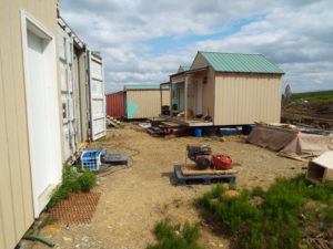
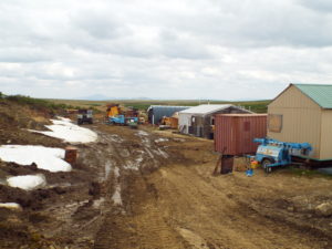
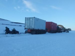
The property is tundra covered with willow patches to heights less than 10 feet. There are no trees of any size and trails (about 8 miles) from the graveled Kougurok road to the property are almost impassible with anything other than tracked vehicles. Furthermore, the Pilgrim River and Iron Creek must be crossed when water flow is relatively steady and low. The Pilgrim River usually prevents crossing due to high water and ice until late May or early June. A mining camp exists on the private patented property that can house a dozen people with a cook shack and several containers and workshops. The camp is ideally located to access surrounding potential claims to explore and Hydro-Scopic™ mine deep channels showing drifting indications paying at least 8 grams per yard and much more in some cases. The property surrounding this private target property is Alaska State land and is currently unclaimed. There are tens of thousands of available acres surrounding the property that have good potential for deep Hydro-Scopic™ mining making Sherrette Creek an excellent staging area. The property owners contracting for Beta testing will have the right to claim or purchase any surrounding mineral rights that attach to the designated Sherrette Creek patented property. All property beyond that realm will have rights to be acquired by Hydro-Scopic™ Properties, LLC.Logistics:
The mining location is about four hours from Nome where fuel and supplies are plentiful at a much inflated price as everything is usually flown in. The only way to get to and from Nome is flying, barging, or dog sled. The supply channel is quite good, however, as most repair parts are within a day or two with air service from Anchorage. Rooms during the summer are difficult to get as it is a small town and any increase in construction or mining will occupy vacancy availability. Typically when we plan for Hydro-Scopic™ activity we will provide motor homes for the crew so as not to disrupt a community’s lifestyle for their occupants. Winter weather can be extremely cold. Hydro-Scopic™ mining can operate in this cold during an extended mining season depending on supplies and fuel. The present mining camp will have to be upgraded and if profits are substantial a helicopter could solve any supply problem. After all, the old drifter’s (underground miners at the turn of the century) would spend the entire winter at Sherrette Creek drifting in high-value ground at 70 feet or more. They ate their mules and horses when they ran out of food and survived in tents. Of course it is a bit difficult to eat a drill rig, but a snow cat could get them into Nome if things got bad.Environmental and Community Sensitivity:
The Bering Straits Native Corporation along with several other native corporations own much of Alaska and allow mining of their properties under circumstances that protect their rights and the environment. We personally have a good relationship with the office in Nome and lease a right-of-way to Sherrette Creek. We have given them a short summary of what we will be doing with Hydro-Scopic™ mining and they seem quite interested in the possibilities as applied to their property and “franchise mining” involvement with their tribal members interested in gold mining and preserving the environment. Currently we will be actively seeking their involvement and other tribal involvement in prototype funding as it would give them a 50% stake in all that we will be doing with Hydro-Scopic™ mining throughout the United States and global application. The city of Nome is a sensitive community requiring attention to their norms. It is important that we get more involved with community services and activities to preserve our right to mine on the Seward Peninsula without causing a disturbance within the community. Currently, Alaska Mines Corporation has a very good reputation in Nome with the local miners and claim owners. Hydro-Scopic™ mining is also of great interest as it will open up a new green mining technic that has applications in a number of areas including off shore mining of the glacial terminal moraines that have no possible way of recovering the gold buried under boulder fields with some boulders the size of houses. These boulders actually make Hydro-Scopic™ mining possible in offshore leasing rights to mine gold.Classification of Mineral Property:
It should be clear that Hydro-Scopic™ mining provides a special technic to actually increase the confidence level that mining of a property can be profitable and thereby increase or decrease the mineral classification. It does this by providing daily volume testing of actual mining a deposit at depth and measuring gold recovery on a time basis not a cubic yardage basis. If a Hydro-Scopic™ mining company needs ten ounces a day for a 25 day month to provide a good rate of return to the debt and equity holders of the company, it does not matter what you are getting per cubic yard at 100 feet verses 500 feet. You need 10 ounces per day, period! Hydro-Scopic™ mining can provide this measure making mineral classification quite reliable. Until we can Hydro-Scopic™ test Sherrette Creek, it has no real value classification as there are no test results that can provide a confidence level that the gold is measurable enough to establish a classification that it is nothing more than an “inferred” deposit. However, the history indicates that it is certainly worth testing. Upon realizing the potential proven by the Hydro-Scopic™ prototype, all the available state lands around Sherrette Creek will be claimed for mineral rights. The property certainly has gold concentrations on the surface and historical references to drifting that should pay more than ¼ ounce per yard in subsurface deposits from 70 to 180 feet. It was noted in the 1908 report that nuggets including one that weighed 10 ounces was sold for $200 came from subsurface deposits. Presently the property is worthless unless gold goes to well over $2,000 an ounce which will open up the surface mining operation. The equipment is still in place and the mining camp is ready to be occupied. A successful Hydro-Scopic™ operation could make it worth a billion dollars with the surrounding mineral rights obtained for future subsurface Hydro-Scopic™ environmental mining. We are talking thousands of virgin acres paying more than the tons of gold recovered by the old miners more than a century ago.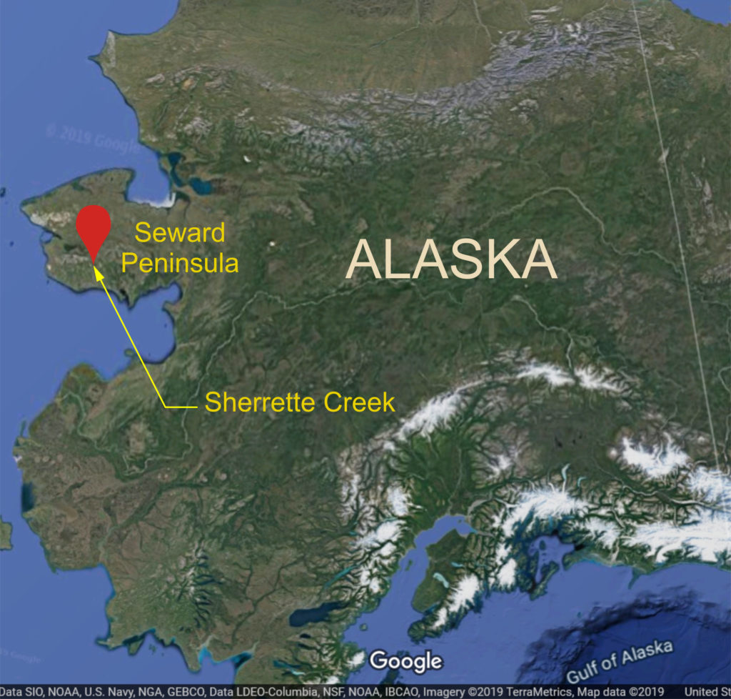
PINE CREEK
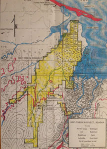
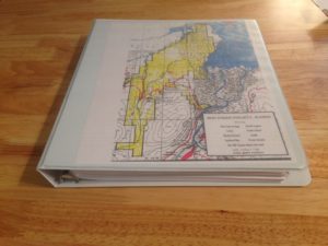
MUD CREEK
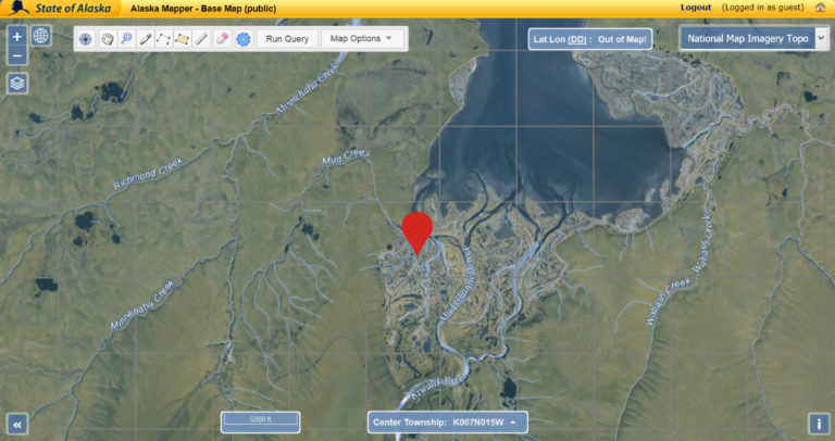
Candle, Alaska
Location & Accuracy
The Minnehaha Creek placer mine is about 2.5 miles northwest of Candle. The mine extends downstream for 1 to 2 miles from near the cabins at the head of Mud Creek, which nearly joins Minnehaha Creek at the south end of the workings. The map site is in section 2, T. 6 N., R. 16 W., of the Kateel River Meridian. Cobb, 1972 (MF-389), location 17. This site is commonly referred to as the Mud Creek mine.
Geologic Description
Small-scale underground drifting was done on the property when it was discovered in the early 1900s. A drilling program was done by Havenstrite in 1941 to identify reserves, which they mined for the next few years. Noranda explored the property in 1982-83 with a drilling program. The property has been mined on a small scale almost continuously to the present (1999).
Exploration
Small-scale underground drifting was done on the property when it was discovered in the early 1900s. Havenstrite completed a drilling program in 1941 and mined the property for a few years. Small-scale surface mining was done until 1982 when Noranda Exploration acquired the claims and drilled 72 holes totaling 4,200 feet. Noranda dropped the claims after a few years and small-scale mining and assessment work continued on the property to the present (1999). The gravel is frozen and ice lenses are present in the muck and gravel.
Reserve Estimates
In 1941, a drill program by Havenstrite was completed which delineated indicated reserves of 48,000 ounces of gold in 1.8 million cubic yards of gravel. Reevaluation of the drill logs by C. Herbert in 1979 indicated existing reserves of 27,940 ounces of gold, or 1.12 million cubic yards of gravel that contained 0.025 ounces gold per cubic yard. In 1982, Noranda Exploration drilled 72 holes that totaled 4,200 feet. Noranda (1983) calculated reserves at Mud Creek as 73,000 ounces of gold in 2.8 million cubic yards of gravel. Estimated reserves as of October, 1996, were more than 50,000 ounces (Johnson, 1996).
Production Notes
Production between 1947 and 1980 was probably about 10,000 ounces of gold from 277,890 cubic yards of gravel. The property has been actively mined since the mid-1980s. From 1992 through 1996, approximately 3,000 ounces were produced.
References
VALDEZ CREEK
Fairbanks, Alaska
Location & Accuracy
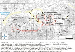
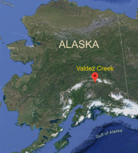
This site represents an area of placer gold mining that extends from near the mouth of Valdez Creek, upstream at least as far as White Creek and Lucky Gulch. The map site is on lower Valdez Creek, about a half-mile downstream from the historic mining town of Denali. The site is in the NW1/4 of sec. 24, T. 20 S., R 1 E., of the Fairbanks Meridian. This location is accurate to within a quarter mile.
Geologic Description
The fineness of the gold runs about 852 with only minor variations. The gold itself showed several different varieties. Most of the gold is ‘oatmeal’ sized and shaped; other varieties include well-polished and rounded grains, rough, angular, and quartz-rich grains, and rough, angular, and oxide-coated grains.
Exploration
Lower Valdez Creek was mined by hand methods after discovery in 1903. The Tammany Channel was mined by underground methods for a distance of about 3,500 feet from the confluence of the channel with Valdez Creek. The Dry Creek cut was mined by hand methods and hydraulicked. The lower portion of the Tammany Channel was hydraulicked. Channels A and B were mined by large-scale, open-pit methods for a distance of several miles upstream after have been thoroughly explored by reverse-circulation drilling during the period 1984 through 1994.
White Creek has been mined by small-scale methods below the west slope of Gold Hill and by open-pit methods just above its confluence with Valdez Creek. Lucky Gulch and its downstream extension has been mined by hand and by small-scale mechanical methods.
Reserve Estimates
Proven reserves are small because of a lack of detailed drilling. A very large quantity of gold remains but is not economic to mine at this time (1999). Detailed drilling in the most promising areas could reveal as much as 100,000 ounces of proven reserves.
Production Notes
Recorded production for the Valdez Creek drainage and its tributaries is about 650,000 ounces.
References
BLUFF BEACH
Nome, Alaska
One of the Richest Beaches Ever Mined
(Reprinted from the California Mining Journal)
https://www.icmj.com/magazine/article/one-of-the-richest-beaches-ever-mined-3233/
April 2015 by Jim Halloran
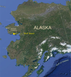
Everyone has heard of the golden beach at Nome, but Nome did not have the richest beach. The truth is the richest beach in Alaska and perhaps the entire world was at Bluff, Alaska, or so say the reports. Bluff’s beach, 50 miles east of Nome, was “…one of the richest beaches ever mined” (Collier and others, 1908). It may not have produced as much total gold as Nome’s beach because the beach at Bluff is much smaller, but its gold per square foot was richer than Nome. The onshore placers at Bluff have been mostly exploited today, but the offshore submerged beaches and former channels of Daniels Creek remain mostly unmined.
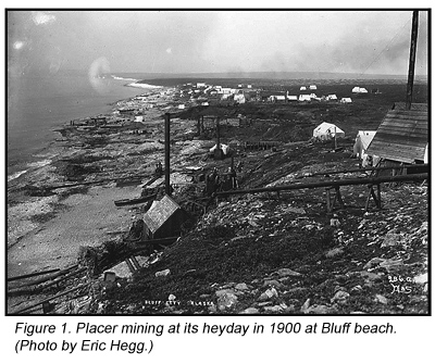
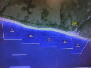
Bluff’s beach gold was discovered in September of 1899 at the mouth of Daniels Creek by William Hunter and Frank Walker, and claims were staked during the following winter. The discovery of gold at Bluff did not reach the outside world (Nome) until March of 1900. By the late summer of 1900, the “easy” gold was practically mined up. In the span of that one year, 29,000 ounces had been scooped up from about 1,000 feet of the shoreline (figure 1). Beach mining extended for about three miles to the west of Daniels Creek. The really rich golden placers were developed by the surf reconcentrating the stream placer of Daniels Creek.
The placers on Daniels Creek were also intensely mined, as shown in figure 2. The nearby lode deposits were located, staked and being mined by 1900. A ditch system was constructed to supply water for hydraulic mining that same year. The neighboring creeks, Eldorado and Swede, were mined by the time WWII shut down gold mining. The miners at Daniels Creek discovered the gold they produced came from a series of connected sink holes in the marble bedrock. Some of the sink holes near Norton Sound were deep enough to be below sea level. This indicated to them that sea level was lower in the geologic past and the rich Daniels Creek paystreak extended offshore for some distance.
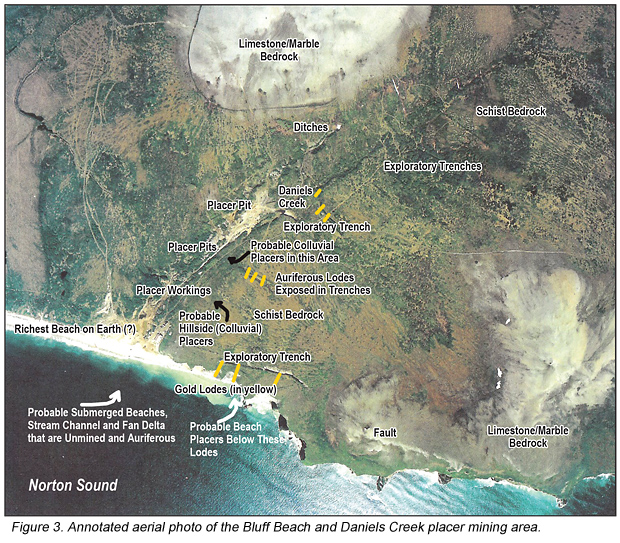
Bedrock in this district is quartz-mica schist, limestone or marble (sometimes called meta-limestone) and an altered intrusive rock. Lode gold along with pyrite, arsenopyrite and chalcopyrite were found with quartz and calcite veins piercing the schist. Other heavy minerals include magnetite, ilmenite, and cinnabar. Three lodes were exposed in the sea cliffs (figure 3 on page 22) where they were striking in a northerly direction as far as 4,000 feet. The lodes in the cliffs were 60 to 165 feet wide and widen to the north to 100 to 200 feet (Mulligan, 1971). The grade of the quartz veins was 0.029 to 0.058, with the best at 0.42 ounces per ton. The lodes were explored and exploited with pits, trenches, shallow shafts and adits in the sea cliff.
Near the mouth of Daniels Creek there were at least two beaches with one being about ten feet above the present beach. The richest portion of the beach was from 500 feet west to 50 feet east of the mouth of Daniels Creek where a foot of clean sand on top of three to four feet of gravel rests on a firm clay false bedrock. A third beach is more inferred than proven to be about 50 feet above the present beach on a bluff. At this elevation a small, wave cut terrace has been found, but it does not contain much gold.
The total gold production from this area exceeded $1 million (48,375 troy ounces) from Daniels Creek and Bluff Beach by 1904 (Collier and others, 1908). Mulligan (1971) reported the total gold production from the placers was 89,140 fine ounces, while lode production was negligible.
The beach gold was coarser than the gold at Nome beach, no doubt due to much less travel distance from the lodes to the beach. The fineness of the gold is 870. At $20.67 gold, it averaged a dollar to the pan. Brooks (1901) wrote, “This is far richer than the best part of the Nome beach sands, and, in fact, is the richest marine placer ever found.” It must have been happy times at Bluff in those days!
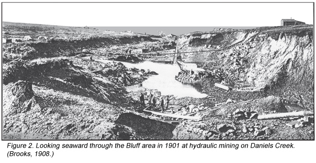
Daniels Creek is a one-mile-long drainage that flows south to its mouth on Norton Sound at Bluff beach. Gold miners on Daniels Creek plucked gold nuggets from crevices and potholes in the marble floor that were deep enough to require the hoisting of buckets of auriferous gravels. The pay channel is very irregular as small cavern features such as solution channels, potholes and tunnels are well developed. Since these features developed below the present sea level, they must have formed when the sea level was lower. It was apparent to the miners that the pay channel extended offshore. In fact, the paystreak of Daniels Creek went below sea level for several hundred feet upstream from its mouth. Some of the excavations were 50 to 60 feet below sea level.
In the 1930s, a modified high-line dragline was used to mine the nearby seafloor (Mulligan, 1971). The offshore pay zone was defined by a self-propelled 6-inch churn drill that operated on sea ice during the winters. The offshore dragline mining of the 1930s was inefficient at exploiting the deeply entrenched and winding channel paystreak and may have mined sea bottom sands by mistake at times. Mining offshore was done in the winter through the ice, but it was made challenging and hazardous due to movement of the ice. The gravels mined in the winter were stockpiled on shore for sluicing during the summer. Subsequent attempts during the 1970s at offshore mining using suction technology were unsuccessful.
The gold lodes are associated with the contact between the schist and the marble. An intensely fractured zone in the schist averages 0.015 to 0.017 ounces per ton gold and 0.03 to 0.05 ounces per ton silver for outcrop widths of 200 to almost 500 feet (Mulligan, 1971). The gold lode workings in the Daniels Creek area consist of a caved-in adit in Bluff cliff and more than 50 pits, trenches and timbered shafts. The auriferous veins are composed of quartz and calcite. The dumps are not large enough for extensive stoping; however, it is likely that some of the waste rock was dumped into the sea from adits in the cliff. One adit was reported to be 300 feet in length with winzes and crosscuts.
The best gold concentrations were residual placers on the surface of the clayey decomposed schist. Like so many placer districts around the world, the lodes were too small or poor to develop hardrock operations. There is little gold in Daniels Creek upstream of the lodes in the schist.
In 1983, Aurick Offshore Mining Co. hired Phoenix Marine Engineering Inc. to dredge near the mouth of Daniels Creek. They only applied to mine 100 acres in waters from 10 to 30 feet deep during ice-free times of the year. The plan was to mine 1,000,000 cubic yards a year for ten years. Unfortunately they were met with howls of protests from the usual environmental groups that believed mining no more than 100 acres out of hundreds of thousands of offshore acres would adversely affect the whales that occasionally swim by Bluff. There are no year-round residents of Bluff anymore.
In 1986, BHP conducted geological, geochemical, geophysical and core drilling programs looking for lode gold. BHP discovered significant drill intersections as high as 5.48 grams per ton (g/t) gold over 36 feet. In their report, they noted a resource of 300,000 ounces in 3,000,000 tons of 3.43 g/t ore near Daniels Creek. In recent years, Millrock Resources picked up where BHP left off with more geologic mapping and soil sampling of new mineralized zones in bedrock sources of the gold at Bluff. In 2010, Millrock had a drill intersection of 103 feet of 3.8 g/t and another of 9.0 g/t over 40 feet. Due to the structural complexity of the geology, they flew detailed airborne magnetic and radiometric surveys. Millrock entered into an exploration agreement with Ryan Gold and Bering Straits Native Corporation at Bluff. In 2013, Millrock dropped the Bluff lode project.
The seafloor offshore of Bluff has a reputation of having lots of old mining debris, which creates a hazard to new mining. A new operation would be well-advised to clean up enough of the cables and scrap metal parts to mine safely. Another risk is the chop of the waves, which is reported to be really tough on boats. The weather and surf conditions can get tough and there is no harbor for shelter nearby.
A note about prospecting beaches for placers: there are some common factors to look for. One of the factors is exemplified at Bluff; in fact it is the word “bluff,” or sea bluffs. Many beach placers are associated with seashore bluffs. The bluffs are the result of a shoreline that is rapidly eroding. The surf, usually during storms, undermines the toe of the bluff slope, causing it to slough down onto the beach where the heavy minerals are naturally sluiced into beach placers. Not all beach placers are associated with bluffs, but the majority of them are. Conversely, not all golden beaches are associated with sea cliffs. The present beach at Nome is an exception to the previous sentences, but the Nome district has so many lodes over a very large area. The Third Beach at Nome follows the rule with a bluff above it. Needless to say, not all beaches with bluffs have gold placers, but other heavy minerals are likely to be in placer concentrations on those beaches, too. Gold Bluffs Beach, Oregon and Cook Inlet beaches in south-central Alaska are other examples and there are many more examples too numerous to cite.
It is highly likely that additional gold can be found in the colluvium between the lodes and Daniels Creek, as shown in figure 3. The natural appearing vegetation pattern indicates the area has not been mined; however, it is possible the hillside has been mined since the aerial photo was taken in 1998.
_______________
Sources
- Brooks, A.H., 1901, “A Reconnaissance of the Cape Nome and Adjacent Gold Fields of Seward Peninsula, Alaska, 1901;” U.S. Geological Survey, Special Publication.
- Collier and others, 1908, “The Gold Placers of Parts of Seward Peninsula, Alaska;” U.S. Geological Survey, B 328.
- Mulligan, J.J., 1971, “Sampling Gold Lode Deposits, Bluff, Seward Peninsula, Alaska;” U.S. Bureau of Mines, RI 7555.
© ICMJ’s Prospecting and Mining Journal, CMJ Inc.
